UN
5 Welbeck Road
£ 249,950
Description
We don't have a Description for this property.
- Bedrooms
- 3
- Bathrooms
- 0


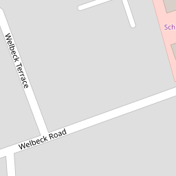

Leaflet © OpenStreetMap contributors
The heatmap indicates the level of crime in the area. The color of the heatmap indicates the crime severity and recency.
Metrics Year-on-Year
- Average area value
- 307,499.00 £Increased by 5.42 %
- Average area rental value
- 999.00 £/moIncreased by 5.94 %
- Est rental Yield
- 3.90 %Increased by 0.52 %
- Crime Rate
- 4.00 %Unchanged by 0.00 %
from 291,693.00 £
from 943.00 £/mo
from 3.88 %
from 4.00 %
Nearby Schools
| Name | Type | Ofsted | Distance |
|---|---|---|---|
| St Teresa'S Catholic Infant And Nursery School | Voluntary Aided School | Good | 0.71 KM |
| Birkdale Primary School | Community School | Good | 1.02 KM |
| Our Lady Of Lourdes Catholic Primary School | Voluntary Aided School | Good | 1.35 KM |
| Linaker Primary School | Community School | Requires improvement | 1.44 KM |
| Christ The King Catholic High School And Sixth Form Centre | Voluntary Aided School | Requires improvement | 1.52 KM |
Images
Nearby Streets
| Name | Average Price | Average Sqft | Distance |
|---|---|---|---|
| The Walk | £ 195,000 | 0 | 0.00 KM |
| Belgrave Place | £ 629,999 | 0 | 0.00 KM |
| Priory Gardens | £ 549,997 | 0 | 0.00 KM |
| College Close | £ 0 | 0 | 0.00 KM |
| Grosvenor Gardens | £ 625,000 | 0 | 0.00 KM |
Nearby Transport
| Name | NLC | TLC | Distance |
|---|---|---|---|
| Birkdale | 2352 | BDL | 0.20 KM |
| Hillside | 2231 | HIL | 1.58 KM |
| Southport | 2262 | SOP | 2.08 KM |
| Ainsdale | 2350 | ANS | 4.57 KM |
| Meols Cop | 2357 | MEC | 4.57 KM |
Nearby Listings
| Address | Price | Type | Score | Distance |
|---|---|---|---|---|
| Welbeck Road, Southport, PR8 4AE | £ 425,000 | BUY | 5 / 10 | 0.01 KM |
| Welbeck Road Southport PR8 4AE | £ 550,000 | BUY | 8 / 10 | 0.01 KM |
| Welbeck Road, Birkdale, Southport | £ 350,000 | BUY | 8 / 10 | 0.05 KM |
| Welbeck Terrace, Birkdale, Southport | £ 275,000 | BUY | 5 / 10 | 0.12 KM |
| Chase Close, Birkdale, Southport | £ 99,950 | BUY | 5 / 10 | 0.16 KM |
Nearby Properties
| Address | Price | Distance |
|---|---|---|
| 9 Welbeck Road | £ 295,000 | 0.00 KM |
| 8 Welbeck Road | £ 430,000 | 0.00 KM |
| 24 Welbeck Road | £ 345,000 | 0.00 KM |
| 13 Welbeck Road | £ 515,000 | 0.00 KM |
| 2 Welbeck Road | £ 375,000 | 0.00 KM |